Map Features

Developed alongside frontline emergency crews.

Advanced Routing

Our bespoke routing engine knows what makes a good route for responders.

Blue Light Routing finds shortcuts through the traffic rules that don't apply to emergency services.

Includes...

  • Blue Light Routing
  • Width/height restrictions
  • Prioritisation of wide roads
  • Accounts for road closures
  • Accurate ETAs
  • Building entrance detection

Detailed Offline Maps

Equipping crews with the same Ordnance Survey data as the control room means clearly labelled buildings - from council estates to farm houses.

Blue Light Alert®

Integration with Waze pre-warns other drivers of approaching emergency vehicles, enabling the public to give way earlier and reduce collision risk.

Street View

House numbers are often difficult to see from the road, so we show responders a photo of the front door as they arrive on scene.

What3Words

Increasingly used to share incident locations, allow responders to search and share w3w locations in one place without switching between apps.

This mode is designed for vehicles responding with warning lights & sirens,
and finds suitable routes that take advantage of exemptions.

Routes suitable for cars

Ensures routes avoid width/height restrictions,
suitable for Ambulances and Police vans/carriers

Designed for Ambulances with patients onboard, finds routes that
avoid speed humps

Ensures routes are suitable for width/height
of fire appliances. Minimises sharp turns.

Mode that follows normal rules of the road

Routing Modes

Here’s an interactive screenshot highlighting the app’s core navigation screen.

Click the hotspots for more details on how our routing features can benefit your emergency teams.

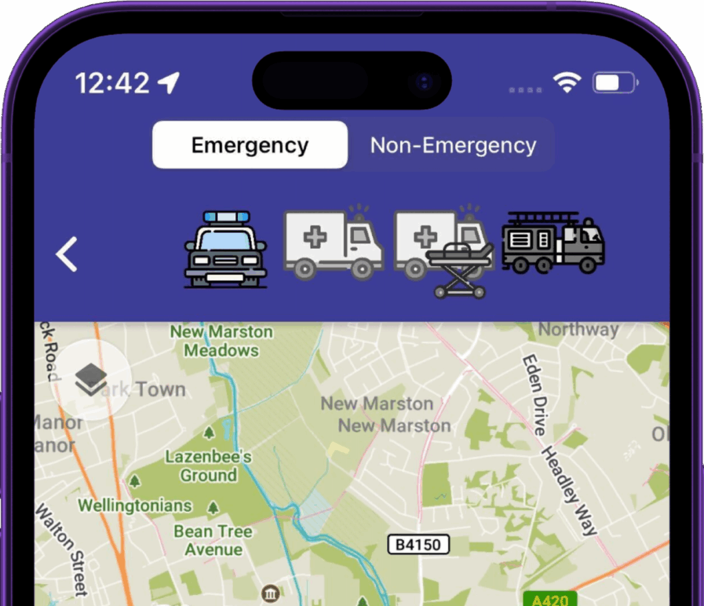
We’re CAD agnostic and slot in alongside your existing control room technology, enabling users to start navigation with a single tap.

It’s often as simple as including links in dispatch notifications, or changing the default map app on the OS.

Alternatively, you can make use of our notifications API.

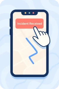
You can optionally allow responders to share their live location – to the control room, and their colleagues.

This valuable situational awareness capability enables effective decision making when dealing with incidents, and during proactive or public order operations.

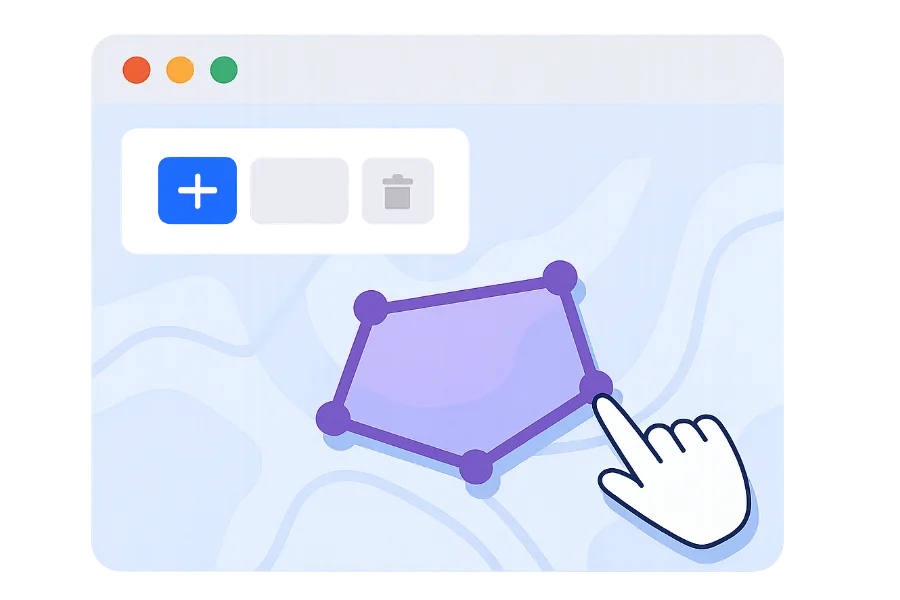
From carnivals and marathons to pre-planned firearms operations, operational planners no longer have to rely on good memory and printing out maps that become instantly lost or out of date.

Updates made on Command Map are made instantaneously available to frontline staff, ensuring everyone’s singing from the same hymn sheet.

FAQ

Frequently Asked Questions

Our responder app works on all Android & iOS devices. Windows device support is also possible.

We have worldwide coverage for core map data, and ensure any local datasets are integrated during onboarding.

We believe in delivering cost effective solutions that enable you to make smarter maps available to your entire workforce. 

We charge on an annual subscription basis based on the number of devices/users in-scope, and any additional services required (e.g. custom data integrations)

More to explore

Plan & Monitor

Plan & Monitor

With our easy to use web mapping solution, operational planners can draw and add custom map objects that sync to responders on the ground.

When the plan is executed, live locations of relevant units are synced back to the web map view.

Let's chat
Connect Your Data

Connect Your Data

Integrate your existing data sources and improve the situational awareness of frontline crews.

Whether it's hydrant data, AED locations or crime hotspots, we'll help make it actionable.

Let's Chat