Maps designed for first responders.
Our mobile app has been purpose-built alongside first responders to deliver them faster routes and improved situational awareness, at a fraction of the cost of traditional solutions.
By leveraging routing exemptions and detailed location data, it transforms any smartphone or tablet into a powerful tool – empowering first responders to act decisively when every second counts.
Reduce response times
Account for blue light exemptions and other traffic restrictions to find routes up to 60% shorter than Google Maps.
Offline maps
Even in areas with poor connectivity, our offline-first approach ensures uninterrupted service.
Improve situational awareness
Harness detailed mapping, location data, and photo previews of incident scenes to give responders a clearer picture before they arrive.
Easy Integration
Plug seamlessly into your existing CAD and mobilisation solutions, and enrich the app with custom map data specific to your organisation’s needs.
Thousands of responders are using Blue Light Maps.
Here’s what they say:
“Have been getting to incidents quicker compared to Google Maps. For instance, today we’ve used a bus only road.
Chad Underwood
Police officer
“A more efficient route utilising exemptions for a no-right-turn saved 3 minutes.”
Paul Smith
Paramedic

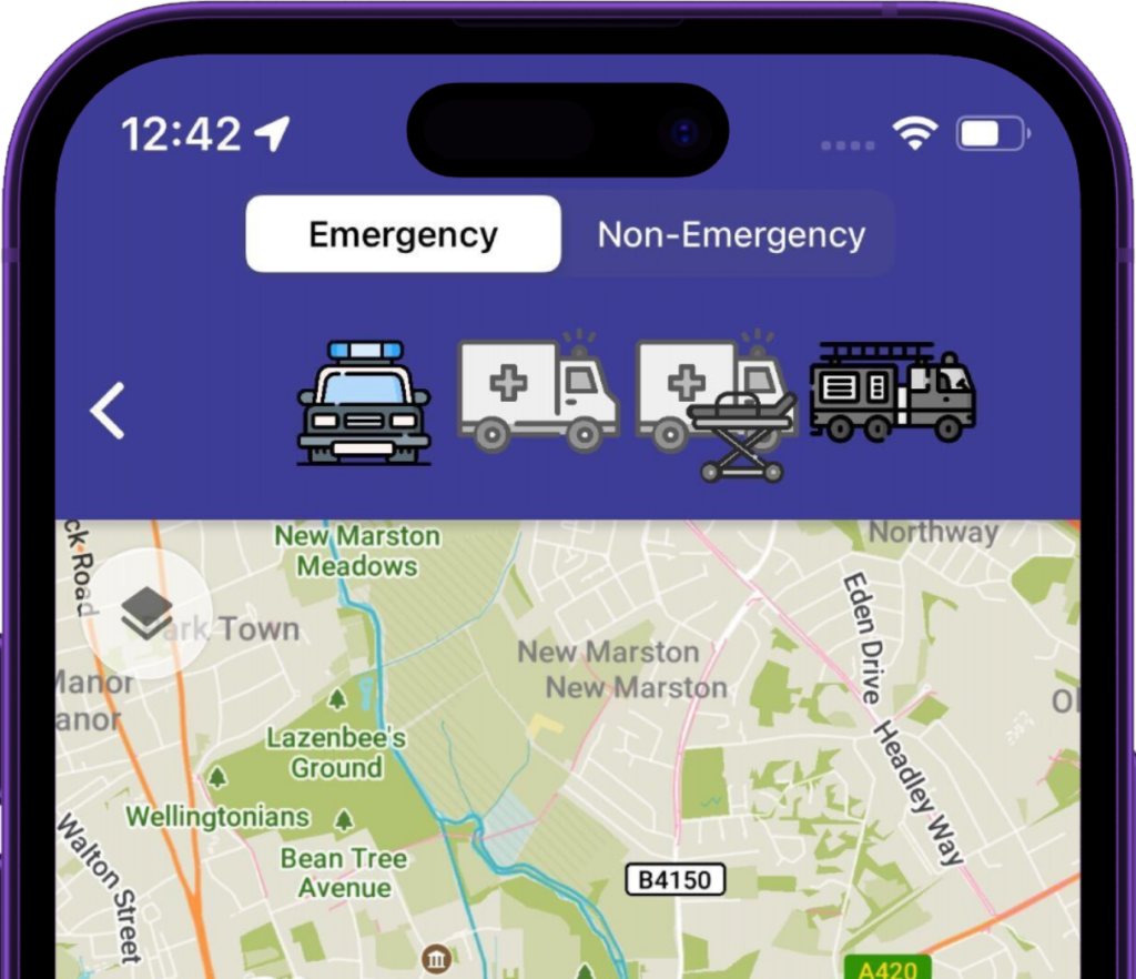
This mode is designed for vehicles responding with warning lights & sirens,
and finds suitable routes that take advantage of exemptions.
Routes suitable for cars
Ensures routes avoid width/height restrictions,
suitable for Ambulances and Police vans/carriers
Designed for Ambulances with patients onboard, finds routes that
avoid speed humps
Ensures routes are suitable for width/height
of fire appliances. Minimises sharp turns.
Mode that follows normal rules of the road
Take a sneak peek.
Here’s an interactive screenshot highlighting the app’s core navigation screen.
Click the hotspots for more details on how our routing features can benefit your emergency teams.
Cutting-edge features
that drive performance
Blue Light Routing
Whether it's exemptions from bus gates, low traffic neighbourhoods or secret motorway access points - if there's a shortcut, we'll find it.
Detailed maps
Our users value our incredible detail, from phone booths to clearly labelling every UK building with its address.
StreetView of destination
As responders arrive on scene, they are shown a photo of the front door, saving vital seconds in locating incidents.
Timely directions
We know our users often driving fast, so give earlier notice of upcoming turns when they need it.
Offline support
With all map data synced to the device, no internet access is required.
What3Words integration
Responders can search for a W3W location like any other address, and easily view/share with colleagues.

