We believe that tailored mapping solutions have the power to radically improve emergency response. By collaborating directly with first responders from day one, we’ve built a suite of navigation and mapping solutions that address the pressures of real-world situations.
Our products – tested and refined alongside those on the frontline – help police, fire, and ambulance teams respond faster, safer, and better informed. From pioneering routing exemptions to exposing detailed geospatial data, we’re focused on the everyday needs of those that protect our communities.
Our Story
The beginning
Our journey began in 2022 when our founder, a volunteer police officer in East London, realised that traditional navigation solutions were increasingly unsuitable for emergency response.
Geovation
In Q1 2023 we were selected by the UK’s national mapping agency, Ordnance Survey, to participate in their Geovation accelerator scheme for geospatial startups – receiving grant funding and business support.
App launch
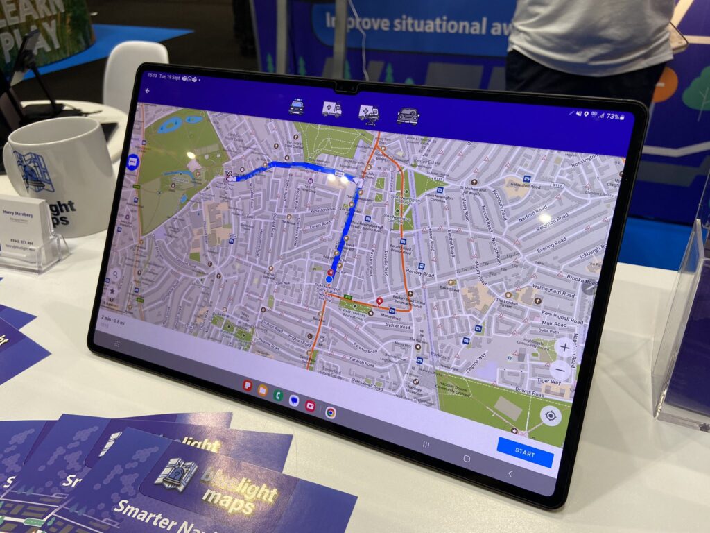
After a year of development and months of real-world testing by responders, we launched our mobile app in Q4 2023 at the Emergency Services Show in Birmingham.
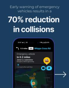
Blue Light Alert®
In 2025 we launched an add-on to reduce the likelihood of collisions while responding to emergency calls.
Through our advanced routing engine and Waze partnership, we help pre-warn other drivers of approaching emergency vehicles.
Contact us
Get Started
We’re ready to help your responders and the wider public.