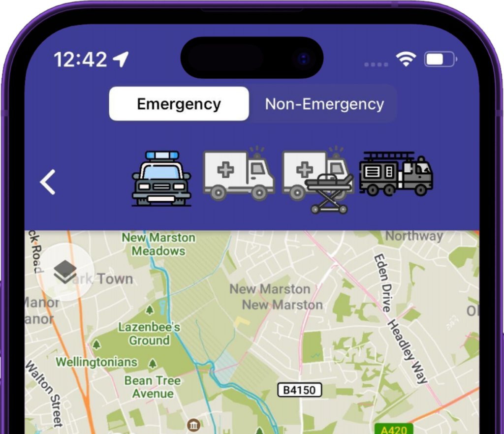
Blue Light Routing: Emergency Service GPS Navigation
We understand that the quickest route for emergency service responders isn’t as straightforward as following standard GPS directions. That’s why we’ve developed our groundbreaking feature – Blue Light Routing.


Beyond Traditional Navigation
Blue Light Routing is designed to optimise routes for first responders by acknowledging the unique exemptions available to them. Standard GPS navigation solutions used by the emergency services overlook these specifics, often recommending longer routes than necessary.
To make matters worse, they will also often direct a larger vehicle down a road with width restrictions.
With Blue Light Routing, that’s no longer the case. We take into account both the driver capability and vehicle characteristics.
Low Traffic Neighbourhoods and Beyond
Urban areas worldwide are witnessing an increase in traffic restriction schemes, such as Low Traffic Neighbourhoods in the UK and School Streets in the EU. While beneficial for reducing congestion and enhancing resident safety, they can lead to the emergency services inadvertently taking the long way round. See how they’re impacting the road network in your area on our map.
Blue Light Routing from Blue Light Maps has been developed to address this challenge. Our navigation tool smartly recognises where emergency services have exemptions from these traffic restrictions. Whether you’re navigating a LTN in London or a School Street in Amsterdam, Blue Light Maps ensures the quickest, most efficient route.

Leveraging Exemptions
In addition to broader traffic restriction zones, Blue Light Routing considers smaller, localised restrictions like “no left or right turn” signs and bus or taxi gates. Our system understands and applies the exemptions for first responders.
Swift Responses with Optimal Routes
With Blue Light Routing, elongated routes are a thing of the past. We help first responders utilise their exemptions effectively, ensuring quicker arrivals at their destinations to deliver life-saving aid.
The maps are downloaded to the users Android or iOS mobile device, and the routing can take place entirely offline – meaning the emergency response won’t be impacted by poor signal or downtime.
We’re committed to equipping emergency services with intelligent, reliable, and efficient navigation tools – because every second counts.
Get in touch to arrange a demo for your organisation.