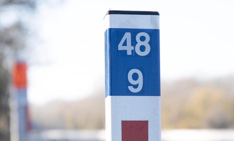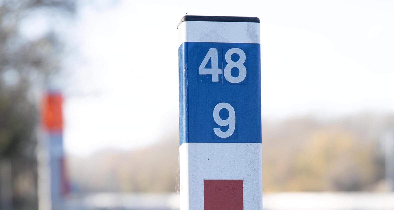
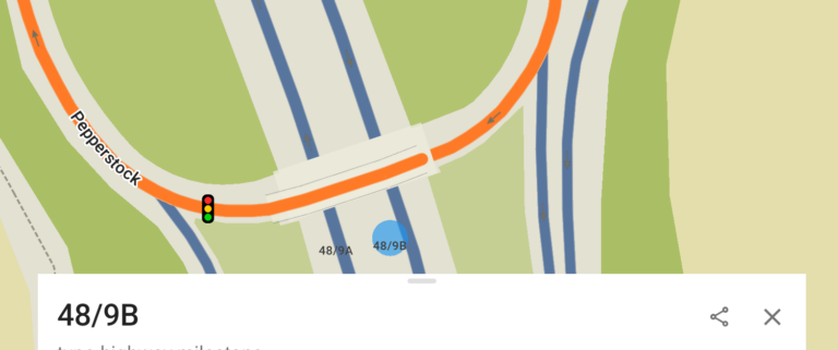
A caller reports an RTC on the M1. They’ve done exactly what the Highway Code tells them to – they’ve found the nearest location marker post: “48, 9B.”
The control room takes the call, logs the reference, and dispatches a crew. So far, so good. The CAD system can handle a marker post reference. The operator knows exactly where that is.
But here’s where it gets interesting. The information now needs to travel.
Maybe it goes out over the radio. Maybe it’s passed later as part of a METHANE message – E for Exact location. “M1, marker forty-eight, nine bravo.” The crew heading to the scene hears the reference. They understand it. But their navigation system – whether that’s a consumer sat nav, their phone, or whatever’s bolted to the dash – has no idea what to do with it.
So the crew falls back to “which junction are we near?” They estimate distance from the last junction they passed. On a dark motorway at 2am, that estimation adds time, adds stress, and adds risk.
The location was precise. The system that received it understood it. But the system that needed to act on it couldn’t.
What these signs actually tell you
Most UK drivers have seen the large blue signs along motorways. Three rows of information: road number, carriageway letter, distance. These driver location signs are spaced every 500 metres. Smaller white distance marker posts also line the carriageways of motorways and major A-roads, at 100-metre intervals. Both use the same system – distance in kilometres from a designated start point, measured to one decimal place.
When someone reads out a marker post reference, they’re giving you a location accurate to 100 metres. On a road stretching over 200 miles, that’s remarkably precise.
The gap isn't in the control room
CAD systems in police, fire, and ambulance control rooms can resolve marker post locations. The operators are trained on them. The problem is what happens after the control room.
When that reference is passed over the radio to a responding crew, it enters a different world. Frontline responders – particularly those without integrated MDT navigation – are working with tools not built for them. Google Maps. TomTom. Waze. None of these can interpret “marker 48, 9B.”
In practice, someone in the control room eventually converts the reference to a description: “between junctions 12 and 13, about a mile past 12.” You’ve gone from 100-metre accuracy to “about a mile.” That margin matters, especially on roads with emergency access points in between junctions.
Closing the gap
If a crew hears “marker forty-eight, nine bravo” over the radio, they should be able to type that into their nav and get routed directly there.
This is one of the datasets we integrate into Blue Light Maps. It’s not flashy – no AI, no machine learning. Just a dataset that should be in every responder’s toolkit.
Have a similar problem in your region? Let us know and we’ll add the data to make your life easier.
Part 1 of our series on why location is harder than it looks for emergency services.