
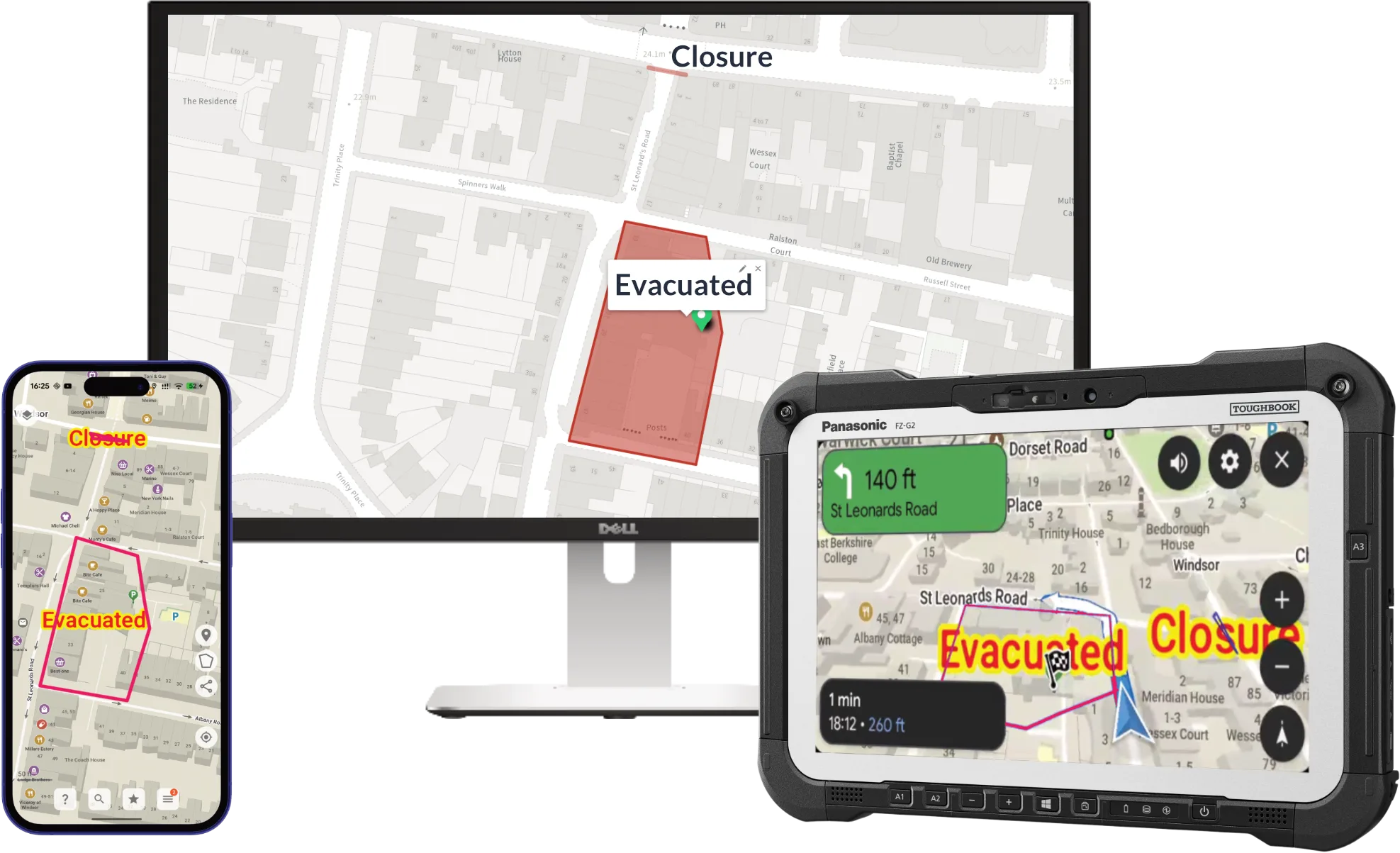
Most emergency services don’t get to start from a clean slate. You already have devices in cabs, on belts and on desks: Android handsets, tablets, Windows Toughbooks and in-vehicle head units, plus the mobilising and MDT software running on them. Blue Light Maps is built to drop into that estate as it is, not make you replace it.
Runs on the devices you already have
The same app, the same map and the same routing run natively across all three major platforms. Roll it out to existing hardware, with no new fleet of devices to procure and no separate setup for each operating system.
In the vehicle, Blue Light Maps projects onto the built-in screen through Apple CarPlay and Android Auto. The dashboard shows the map, the route and turn-by-turn directions. Crews can search by postcode, address or what3words, pick a favourite, and switch between emergency and non-emergency routing without touching the phone. How it works on the head unit.
Deploy it once, control it centrally
Blue Light Maps goes out through the MDM you already run, such as Microsoft Intune, on Android, iOS and Windows.
- Vehicle profiles, set before first use. Choose which profiles crews see and set the dimensions and weight of your fleet, so a crew opens the app and drives. Vehicle profile keys.
- Routing policy, locked where you need it. If your service has decided crews shouldn’t take a particular exemption, such as signed turn restrictions or posted weight limits, set it centrally. The setting is re-applied on every launch and locked on the device. Routing policy keys.
- Shared devices. In-vehicle tablets used across shifts need no personal accounts. Deploying with Intune.
Connects to your CAD, MDT or fleet system
An incident dispatched to a crew should open straight onto the map, with the location and route ready and nothing re-keyed at the worst possible moment. Blue Light Maps connects in whichever way suits your systems and your supplier:
- Inside your MDT app, through our SDK. System integrators build Blue Light Maps into their own products, so crews get emergency routing on the incident screen. Airbus offers it this way in SAFEcommand ScResponse, and Blue Light Maps also integrates with Airbus ScGuide.
- Alongside it, through our CAD API. Your CAD sends the incident to the callsigns attending. Every device on those callsigns is alerted. Re-prioritise, add callsigns or close the job, and every device is told.
- Through the Webfleet API. If your dispatch or fleet system already sends jobs to Webfleet, it can send them to Blue Light Maps too.
- Through deep links. Any app can hand Blue Light Maps a destination, a label such as the incident reference, and the vehicle profile to route with. It’s often the smallest change that replaces a car’s route with an emergency one. Deep links.
Keep it when you change supplier
CAD and MDT contracts run for years, then go back out to tender. Because Blue Light Maps connects through an SDK, an API or a deep link rather than being part of one supplier’s platform, it moves with you. Vehicle profiles, routing policy, custom layers and the habits crews have built stay the same. Only the integration changes. More on choosing navigation on its own merits.
One experience, everywhere
Whichever device a responder picks up, it behaves the same way: the same map, the same routing, the same shared overlays. Someone who trained on the in-cab tablet relearns nothing when they pick up a phone on foot.
And because the map and route calculation live on the device, a device that drops signal keeps routing and holds the latest data, re-syncing the moment the connection returns. If GPS itself can’t be trusted, assisted navigation keeps guiding the crew from where they confirm they are. Data that does leave the device is hosted only in UK and EU datacentres.