
When an area is being evacuated or there’s an incident at a large event, how does every responder on the ground know the detail they need?
Today, it’s usually a radio message, half-heard at speed. Or a screenshot of Google Maps drawn over and sent to an Inbox that gets checked when the shift’s over. Blue Light Maps replaces all of that with a shared map layer that every crew member can see, edit, and navigate from. It updates in real time, on the same device they’re already using.
How it works
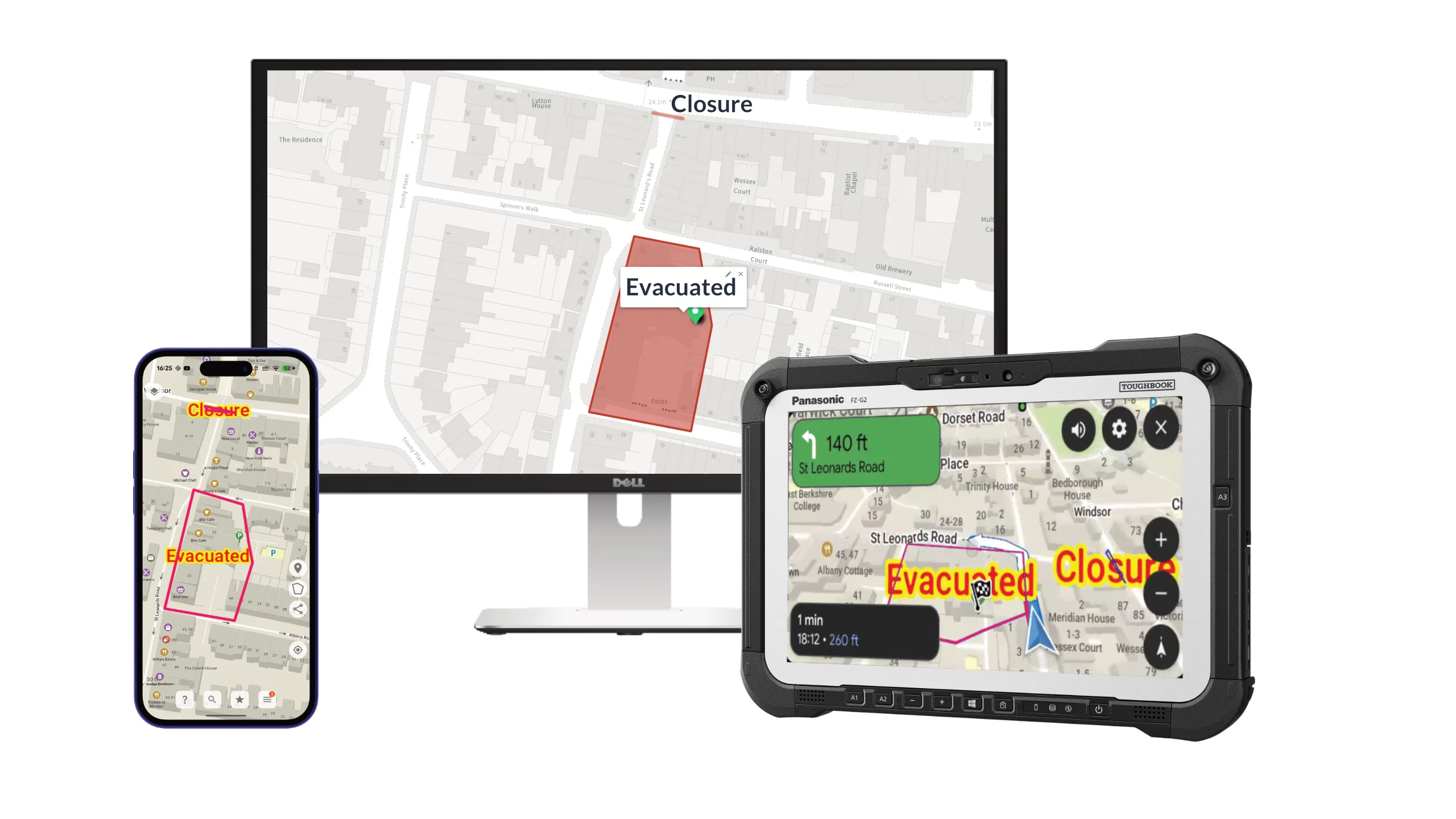
Any crew member can open the overlay and draw on it: drop a pin, draw a boundary, mark a hazard, label an area. Whatever they draw instantly appears on every other device connected to the same overlay. No descriptions to relay or misread. If someone can draw it, everyone can see it.
The officer first on scene marks the RVP, and arriving crews navigate straight to it. A firefighter flags a blocked access route, and every appliance behind them knows before they turn the corner. A supervisor draws a search sector, and the team on the ground sees their area without a briefing.
Plan from a web browser
Not everything happens in real time on scene. Pre-planned events, public order operations, and multi-agency responses often have a planning phase where the operational picture is built in advance.
Our web-based map lets planners and supervisors draw overlays from a browser. Build access routes, medical points and vehicle marshalling areas in a control room, then push them to every frontline device before the operation begins.
Live location sharing
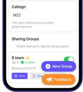
Enable location sharing and supervisors, control rooms, and crew members can see where colleagues are on the map in real time, each marked with their callsign. No more calling in positions one by one.
It’s optional and crew-controlled: shared to invite-only groups a colleague can join with a six-character code, enabled per-operation or left on continuously, depending on your service’s policy. How it works, in the docs.
Shared ETAs
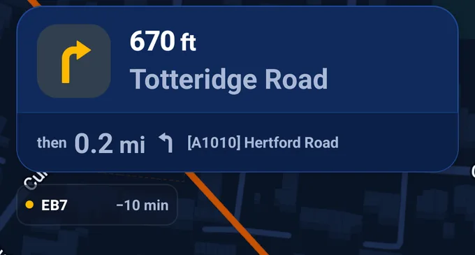
Two crews running to the same incident each see the other while they drive: callsign, status, and a live arrival time, right under the turn instructions. The first crew to arrive keeps the panel on screen, showing exactly how far out backup is.
It’s the ETA the other crew’s own navigation is showing them, calculated for their vehicle under blue-light routing, refreshed continuously as they drive. We’ve written about what that number changes at the door, and on the radio, in why shared ETAs matter in emergency response.
Use cases
Planned events
Marathons, festivals, football matches, protests. Share medical points, access routes, road closures, and RVPs with every crew before they arrive. As the event develops, update the overlay and everyone sees the change. No re-briefing required.
Missing person searches
Divide search areas across teams and watch coverage build in real time. Each team can see which sectors are complete, which are in progress, and where gaps remain. No clipboard at the command post, no radio check every 15 minutes.
Firearms incidents
Share no-go zones instantly on the maps crews are already using for unrelated calls. An armed incident in one area triggers an overlay that every nearby unit sees, whether they’re responding to it or not. Staff safety, without relying on a broadcast that may not reach everyone.
Large-scale incidents
Major RTCs, building fires, flooding. The first crew on scene marks access points, hazards, and staging areas, and every subsequent unit arrives with the picture already built. As the incident develops, the overlay develops with it.
Mutual aid and cross-border responses
When crews from neighbouring services attend an incident, they’re working from the same map. No need to learn local geography from a verbal briefing. The overlay shows what they need to know.
Works across all your devices
Shared overlays sync between phones, tablets and Toughbooks. Everything works offline too: if a device loses signal temporarily, it keeps the latest overlay state and re-syncs when the connection returns.