
Upcoming Blue Light Show1–2 Jul · Olympia, London · See us @ stand Q5 for live demos Event details ↗

Blue Light Routing

Developed alongside emergency crews, our routing algorithms understand what helps first responders get to scene quicker.

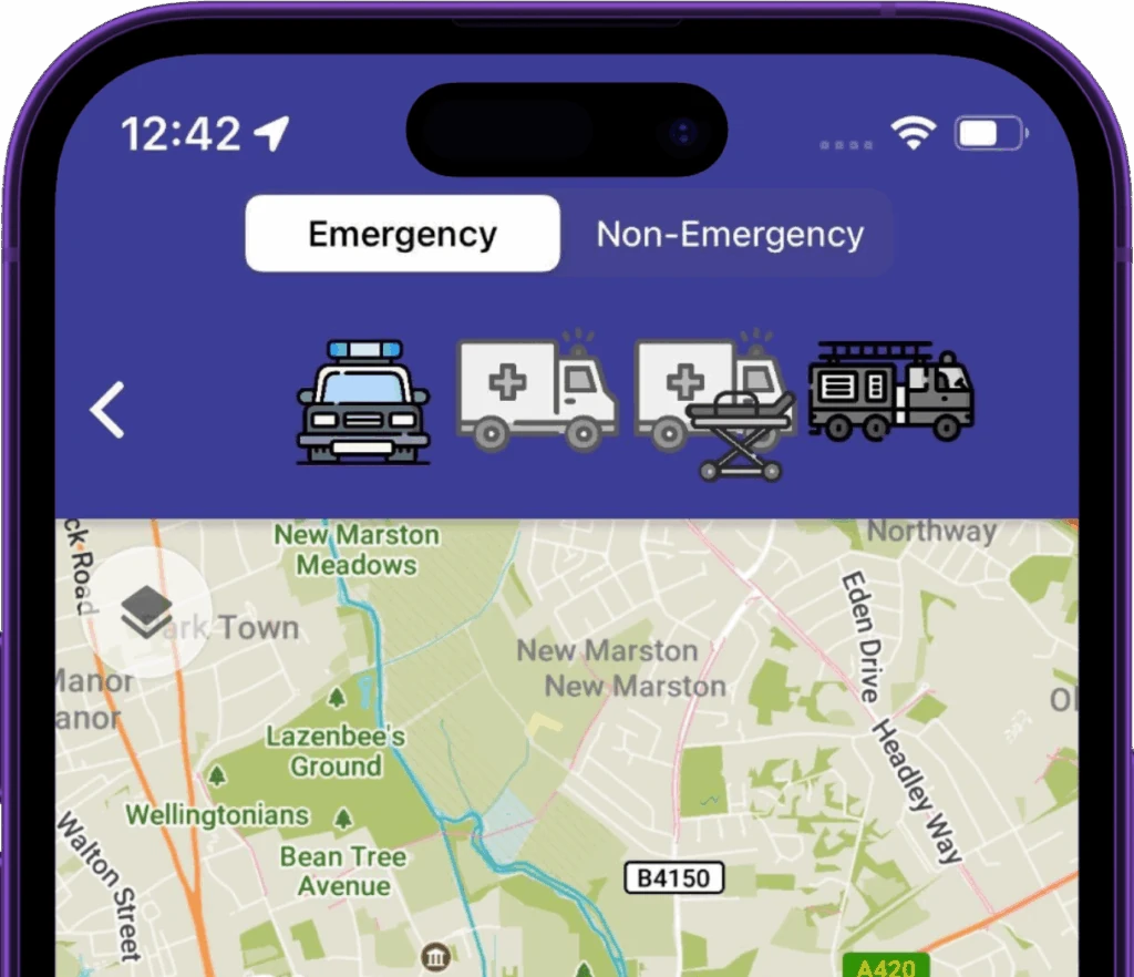
Blue Light Maps routing modes — Emergency/Non-Emergency toggle and per-vehicle routing profiles

Built for crews, not commuters

Other navigation solutions are based on commuter traffic patterns. The map that gets you to work doesn’t understand that you can use a bus lane with blue lights on, or that using a congested but wide road is much faster than diverting down residential streets.

The impact? Over a minute saved on average responding to emergency calls in one police force area.

More traffic reduction schemes. Larger patrol areas. Poor staff retention, less local knowledge.

Generic tools aren’t built for these realities, and response times are paying for it.

Why you should care

Every second of an emergency response gets scrutinised. Call handling and crew turnout are measured, audited and optimised to the second. Driving to scene accounts for more than twice those two stages combined, yet it’s the part many services have treated as fixed and unavoidable.

A Typical Emergency Response*
Call handling · 1m 24s 15%
Crew turnout · 1m 30s 17%
Measured. Audited. Optimised.
Drive to scene · 6 min 11 seconds 68%
Treated as a fixed cost. Increasing year on year.
*MHCLG, Detailed Analysis of Response Times to Fires, England — year ending March 2025 (FIRE1001).

It isn’t fixed. That 68% is exactly where better routing pays off: shaving even half a minute off the drive does more for your overall response time than any further tuning of the stages already running lean - and it’s the lever conventional navigation leaves untouched.

What you can configure

  • Vehicle profile — vehicle type, weight, dimensions
  • Local rules — motorway access points, city center bollards, etc.
  • Driver behaviour preferences — pursuit-aware, smooth-route, fastest, shortest

What the engine accounts for

Beyond exemptions, every route is shaped by the realities of driving a response vehicle:

  • Width, height, weight restrictions: never routed down a road your appliance can’t physically clear, while ignoring environmental HGV restrictions.
  • Offline by default: Map data & routing calculations on your own devices.
  • Road closures: Closures are factored in, no surprises.
  • Precise ETAs: Arrival times & turn instruction timings are grounded in blue-light driving behaviour.
  • Building-entrance detection: guidance to the right entrance, not just the centre of a postcode.

More capabilities

Blue Light Alert®

We can pre-warn nearby drivers that a blue-light vehicle is approaching, so traffic reacts sooner and clears the path for emergency vehicles.

Learn more →

Trusted data

The geospatial data your control room trusts, on the responder's map.

Learn more →

Custom data layers

Overlay your own datasets on every responder's map. Converted from the formats you already hold, visible by role, available offline.

Learn more →

Ready when you are

Equip responders with smarter maps.

30-minute walkthrough. Trial in your area.
No commitment until your team is sold.

Trusted by responders · Operationally proven

Summary

Blue Light Routing is a navigation solution developed with emergency services to optimize response times. Its algorithms understand exemptions for blue light usage and consider vehicle dimensions, road restrictions, and closures to find the quickest routes. The system aims to reduce the significant portion of emergency response time dedicated to driving to the scene, potentially saving over a minute per call.

Key Facts

Frequently Asked Questions

What is Blue Light Routing developed for?

Developed alongside emergency crews, our routing algorithms understand what helps first responders get to scene quicker.

What kind of routes does Blue Light Routing find?

For responding with warning lights & sirens, finds quicker routes that take advantage of exemptions.

What vehicle types are the routes suitable for?

Routes suitable for cars, ensuring routes avoid width/height restrictions, suitable for Ambulances and Police vans/carriers. Designed for Ambulances with patients onboard, finds routes that avoid speed humps. Ensures routes are suitable for width/height of fire appliances. Minimises sharp turns.

What factors does the routing engine account for?

Width, height, weight restrictions, offline map data & routing calculations, road closures, precise ETAs grounded in blue-light driving behaviour, and building-entrance detection.

Related Entities

Companies
Blue Light Maps
Products
Blue Light Routing, Blue Light Alert®
Locations
Olympia, London, England