Street View
Helping responders identify exactly where they’re needed.
Imagine a call to a cardiac arrest. The address is a terraced residential property. As the ambulance turns onto the road, the driver slows down significantly to start trying to find the right address.
Except not all houses have visible numbers, and those that do aren’t easily visible from the road – especially at night. The clock is ticking, and every moment spent trying to translate a pin on a map to the real world location adds to the patient’s risk.


Introducing Blue Light Maps Street View
To address these issues, we’ve added a groundbreaking feature –
Google Street View. Our integration of Google Street View provides a
visual representation of the destination as a first responder arrives on
scene.
Thanks to Street View, responders can now visualise the destination before they arrive. They see the entrance, door colour, any relevant landmarks, and can make a beeline to the patient.
This not only saves time but also reduces the stress of navigating in high-pressure situations.

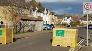
“Have been getting to incidents quicker compared to Google Maps. For instance, today we’ve used a bus only road.
Chad Underwood
Police officer
“A more efficient route utilising exemptions for a no-right-turn saved 3 minutes.”


