
Built around your data, not ours
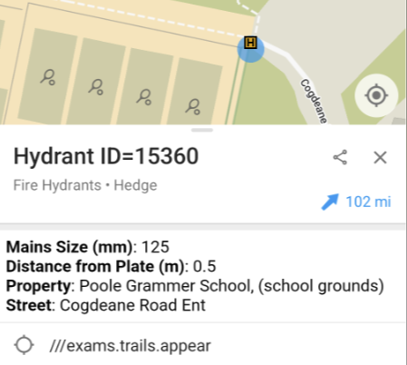
Every service holds data commercial mapping providers never will. Hydrant locations and mains sizes for fire. ANPR cameras and patrol priorities for police. Defibrillators, property risk records, asset stores.
Custom data layers empower the frontline with the data directly on the responder’s map: on every device, in the field, available offline.
Your formats, converted for you
You shouldn’t have to reshape your data to get it on the map. Push it from your GIS or ArcGIS feeds, hand us a CSV export, or upload it directly in a simple admin panel. We convert from the formats you already hold, so a hydrant export becomes a tappable asset that still carries every field it came with.
It’s the same workflow Dorset & Wiltshire use: their team uploads hydrant and risk data in its existing formats, and it’s immediately available to all frontline crews as an overlay on the base map.
Visible when it matters
Layers can sit on by default for the crews who always need them, or stay tucked away for responders to toggle on when a job calls for it.
What you can put on the map
A layer is just points, lines or areas with your data attached, so the possibilities are as broad as your operations:
- Slipways and launch points for deploying rescue boats, with access and tide notes attached.
- Public-access defibrillators, so the nearest unit is one tap away.
- Priority patrol areas based on predictive policing models, refreshed as the intelligence picture changes.
- Water sources, rendezvous points and asset stores for major incidents.
If your service depends on something that’s somewhere, it should live on the map - making it accessible to those that need to know.