In April 2024, ambulances in Israel lost their way. One volunteer ambulance service’s dispatch sends crews their directions through a navigation app, which is of little use when spoofing convinces the phone it is hundreds of kilometres away. Response times suffered, sometimes dramatically, and a medic said it had put people in danger.
Interference has reached the ground
GPS interference is no longer a far-away aviation problem. In August 2026, phones, drones and ships were reported “running blind” across Poland, from interference traced to Kaliningrad. Ukraine’s own anti-drone spoofing has pushed civilians’ phones to Moscow, including their time zone. And in July 2026, EASA revised its GNSS interference guidance for the fourth time. It says spoofing has become increasingly sophisticated and widespread.
That matters in a fire appliance as much as in an airliner. When GPS is jammed, the vehicle’s position on the map freezes or disappears, and the crew can see something is wrong. When it is spoofed, the map puts the vehicle somewhere else with full confidence, and nothing on screen says so.
The UK has already called it a risk
Crews navigate on the same satellites as everyone else: the MDT in the cab, the phone in an officer’s pocket, the ambulance’s vehicle tracking.
Loss of positioning, navigation and timing entered the UK National Risk Register in 2023, alongside a government resilience framework that names emergency services among the dependent sectors. The MoD runs GPS jamming exercises in the UK, which can affect civilian receivers.
Nobody in the cab is lost
When the spoofing reached Tel Aviv, drivers found their navigation and taxi apps placing them in Beirut or Cairo mid-journey. People coped the old way. Israel’s second-largest bookseller reported sales of maps and atlases up by hundreds of per cent, and the country’s former national cyber chief advised the public to go back to maps. UK crews would struggle to do the same: paper map books are no longer distributed in emergency vehicle cabs.
A crew, though, is never really lost. The people in the cab know which road they are on and where the incident is. What fails them is software that stops helping the moment the satellites do.
What we built for that moment
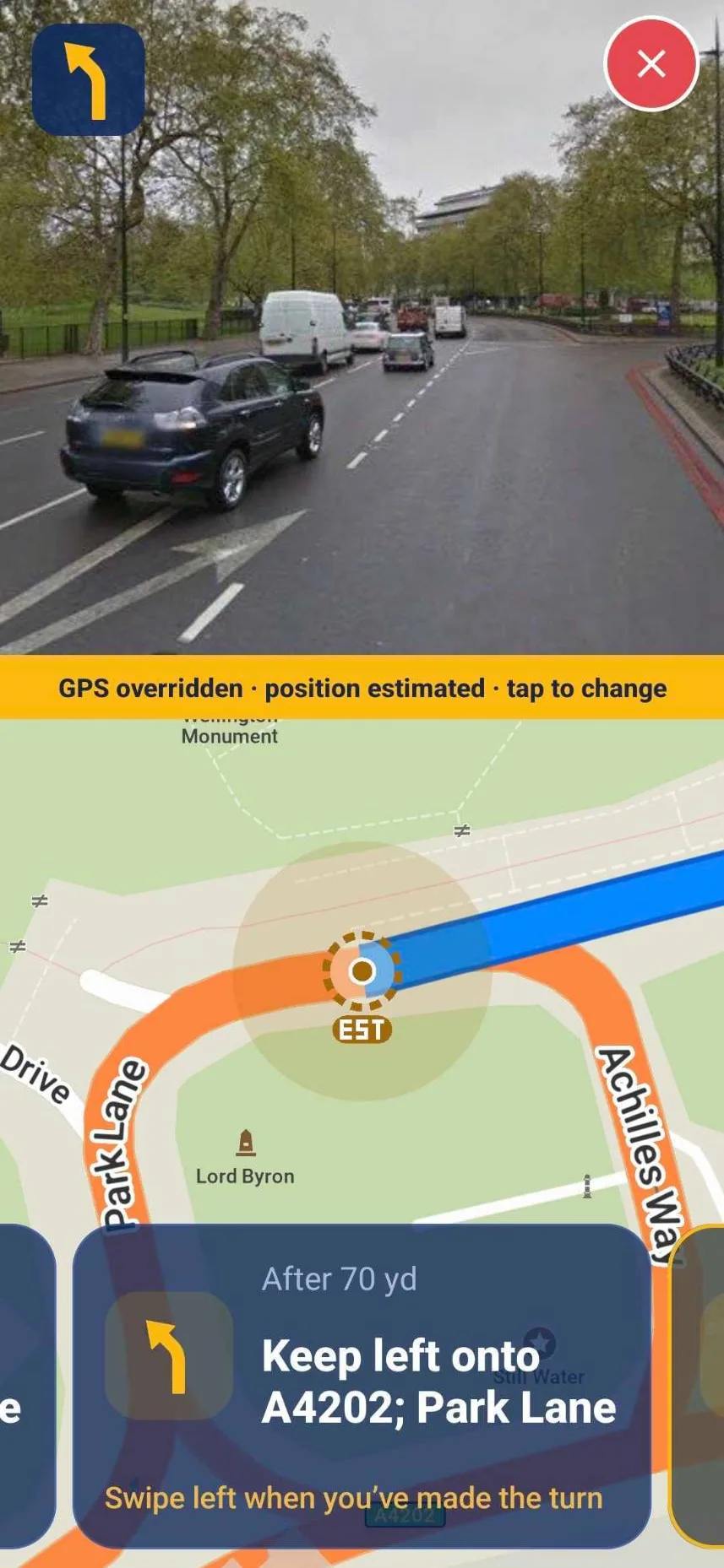
Blue Light Maps now includes assisted navigation for when GPS cannot be trusted. It is the first navigation built for emergency services with a mode for unreliable GPS. A crew can switch it on with one tap, or a control room can flag an area where GPS is unreliable and crews entering it are prompted. The crew confirms where they are on the map, and the app keeps guiding them: a clear, large-type list of every turn to the incident, with an image of what each junction looks like on approach.
Like routing that understands blue light exemptions, low traffic neighbourhoods and bus gates, it is built for the pressured minutes of a response, not the average journey.
It is also the feature we hope nobody ever uses. It is available now to Blue Light Maps customers. If your service would like to see it, get in touch.